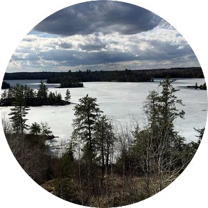
Located within the Superior National Forest in Minnesota’s Arrowhead region, the Hubachek Wilderness Research Center (HWRC) consists of 365 acres of predominantly passively managed boreal-transitional forest landscape. The center is on the north shore of Fall Lake, 8 miles northeast of Ely and 250 miles north of the University of Minnesota's St. Paul campus. HWRC shares a border with the Boundary Waters Canoe Area Wilderness (BWCAW) and is on a BWCAW entry point lake approximately 10 miles south of Ontario's Quetico Provincial Park.
HWRC forests include:
- Approximately 275 acres of upland and 90 acres of lowland forest types
- Nine Native Plant Communities
- Canadian Shield geology of exposed bedrock ridges with intervening swales and acres of morainal deposition
- Shoreline frontage on two lakes of different geologic, limnologic, aquatic, and human-influenced characters
- White pine blister rust resistance research seed orchard
- White and red pine experimental and esthetic plantations
- Documented presence of numerous wildlife species through bird-banding, camera-trapping, snow tracking, small-mammal trapping, and casual photography
Water
HWRC provides direct access to both Fall and Browns Lakes. These access points are open to researchers, faculty, and students engaged in research and educational projects. There is no recreational access via HWRC available to the general public.
Fall Lake
HWRC is situated on Mukluk Bay on the north shore of Fall Lake, which is a public access lake and entry point into the BWCAW. This popular fishing lake is partially developed with private seasonal and year-round homes, a veterans retreat, Vermilion Community College's Outdoor Learning Center, and a Superior National Forest campground. The city of Winton sits at the west end of the lake. Fall Lake receives its inputs from Shagawa River to the west and Garden Lake via power dam from the south. The water flows north into the BWCA out of Fall Lake to Newton Lake via Newton Falls.
- Fall Lake information in MN DNR Lakefinder
Browns Lake
HWRC fronts approximately 25% of Browns Lake shoreline on the south and east sides of the lake. The remaining shoreline is primarily private seasonal and year-round residences. The lake has no public access and no documented invasive species. With intact aquatic macrophyte beds, its water quality and shoreline are demonstrably different from Fall Lake’s. Browns Lake was historically named Otter Lake, and today there is still ample evidence of otter presence on the east and northeast shorelines.
- Browns Lake information in MN DNR Lakefinder


